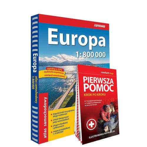
Europe road atlas 1:800,000 + First Aid - Step by Step - Illustrated Instructions
Manufacture:
EAN:9788383552538
Discover the roadways of Europe with precision and confidence using the "Europa Car Atlas 1:800,000," complemented by a comprehensive illustrated guide for first aid procedures. Published by ExpressMap, this indispensable atlas is an essential tool for travelers, adventurers, and professionals alike. With an approachable format of 22.0x29.0 cm and a softcover binding, it is easy to handle whether on the road or at home planning your travels.
Expertly detailed across 304 pages, this atlas offers a scale of 1:800,000, providing clear and concise mapping of European countries' road networks. Its practical design ensures you have all the information needed to navigate safely and efficiently through the continent.
In addition to its highly detailed maps, this atlas includes an essential guide to first aid, presented through straightforward, step-by-step illustrations. This feature is designed to empower you with critical knowledge and skills to handle potential roadside emergencies, ensuring a safer journey.
Crafted in the Polish language and destined for release in 2024, this atlas is a must-have for those who value preparedness and reliability in travel. With the ISBN 9788383552538, this atlas stands out as both a practical resource and a valuable educational companion for any traveler venturing into Europe's vast and varied landscapes. Secure your copy today and travel with assurance.
Instructions Included: yes
Weight: 0.87